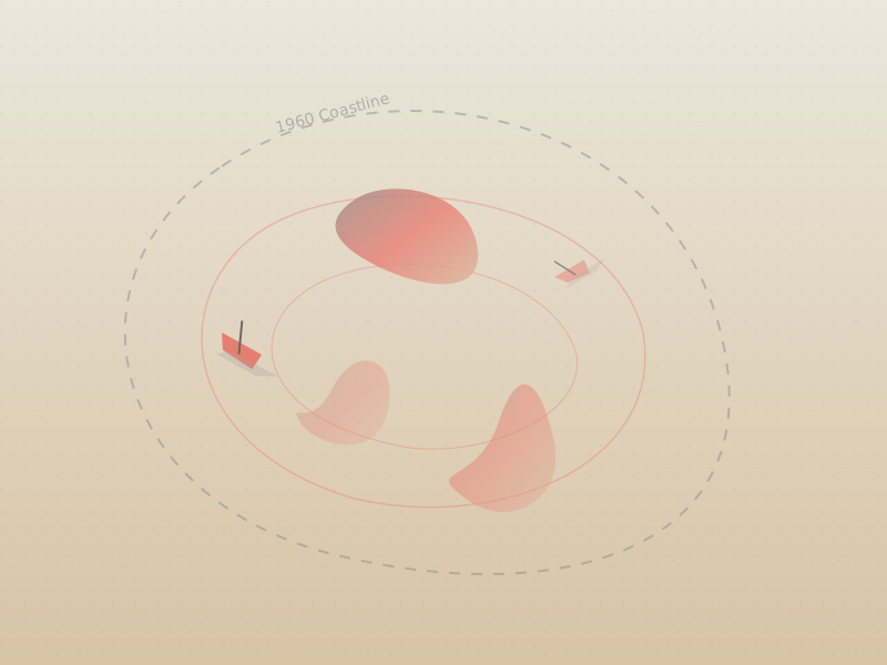
Look at a map of Central Asia printed before 1960, and straddling the border of Kazakhstan and Uzbekistan, you will see a massive blue expanse. This was the Aral Sea, a sprawling endorheic basin fed by two great rivers, the Amu Darya and the Syr Darya. Covering an area roughly the size of Ireland, it was the fourth-largest inland body of water in the world, a thriving hub of commercial fishing and a vital moderator of the regional climate.
Look at a satellite image today, and that vast sea is mostly gone, replaced by a toxic, salt-crusted desert known as the Aralkum.
The shrinking of the Aral Sea is often cited by geographers and environmental scientists as one of the most staggering man-made environmental disasters in modern history. It is a stark geographical cautionary tale about the consequences of attempting to bend nature to industrial will without understanding the fragile balance of hydrological systems.
The Soviet Cotton Dream
The geography of the Aral Sea's demise begins not on its shores, but hundreds of miles upstream in the arid steppes of Central Asia. In the 1960s, Soviet planners embarked on an ambitious agricultural initiative. They wanted to transform the vast, dry plains of Uzbekistan, Kazakhstan, and Turkmenistan into a massive cotton-producing belt. Cotton, famously known as "white gold," is an incredibly thirsty crop.
To turn the desert green, engineers constructed a massive network of irrigation canals, notably the enormous Karakum Canal. They diverted the waters of the Amu Darya and the Syr Darya—the lifeblood of the Aral Sea—into the fields.
The project succeeded in its immediate economic goal: the region became one of the world's leading producers of cotton. However, the cost to the Aral Sea was catastrophic. Stripped of its inflow, the sea began to evaporate under the harsh Central Asian sun faster than rainfall could replenish it.
A Shifting Landscape
By the 1980s, the sea's water level had dropped so drastically that it split into two separate bodies: the smaller North Aral Sea in Kazakhstan and the larger South Aral Sea in Uzbekistan. As the waters receded, they left behind a devastated landscape.
The immediate casualty was the local economy. Thriving port cities like Moynaq in Uzbekistan suddenly found themselves miles away from the shoreline. Fleets of fishing boats were stranded in the desert, their rusting hulls becoming iconic, haunting monuments to the vanished waters.
"We used to look out of the window and see the sea. Now, you drive for hours into the desert just to find a puddle. It feels like the earth simply swallowed our livelihood."
But the geographical changes extended far beyond the shoreline. As the sea shrank, its salinity skyrocketed, killing off nearly all marine life. Furthermore, decades of agricultural runoff laden with pesticides and fertilizers had accumulated in the lake bed. When the water evaporated, it left behind vast plains of toxic salt and dust.
Fierce winds now whip across the Aralkum Desert, picking up this toxic dust and carrying it for hundreds of miles. The fallout has caused severe respiratory illnesses, high rates of cancer, and infant mortality in the surrounding communities.
Even the climate changed. The vast body of water used to moderate the harsh continental climate of the region. Without it, the area now experiences hotter, drier summers and significantly colder, longer winters.
A Tale of Two Seas
Today, the fate of the Aral Sea is a split narrative. In the early 2000s, Kazakhstan, with funding from the World Bank, constructed the Kok-Aral Dam. This earthen dam prevents water from the Syr Darya from flowing into the barren southern basin, pooling it instead in the North Aral Sea.
The results have been remarkably encouraging. The water levels in the North Aral Sea have risen, salinity has decreased, and fish have returned. The fishing industry in towns like Aralsk is experiencing a modest revival, proving that targeted geographical interventions can reverse some ecological damage.
However, the South Aral Sea in Uzbekistan faces a much grimmer reality. The Uzbek government has largely prioritized continued cotton and natural gas production over restoration. The southern basin has mostly dried up, leaving behind a harsh, unforgiving desert landscape.
The story of the Aral Sea is a profound lesson in environmental geography. It illustrates the deep interconnectivity of natural systems and human economies. When we divert a river, we do not just move water; we alter climates, reshape landscapes, and redefine the geography of human existence.
Key Takeaways
- The Aral Sea shrank dramatically after Soviet irrigation projects diverted its feeding rivers to grow cotton in the desert.
- The receding waters devastated the local fishing industry and created the toxic Aralkum Desert.
- The loss of the sea altered the regional climate, leading to hotter summers and colder winters.
- While the North Aral Sea is slowly recovering due to the Kok-Aral Dam, the South Aral Sea remains largely a desert.
References
- United Nations Environment Programme (UNEP), "The Aral Sea Crisis."
- NASA Earth Observatory, "The Shrinking Aral Sea."
- World Bank, "Restoring the Northern Aral Sea."