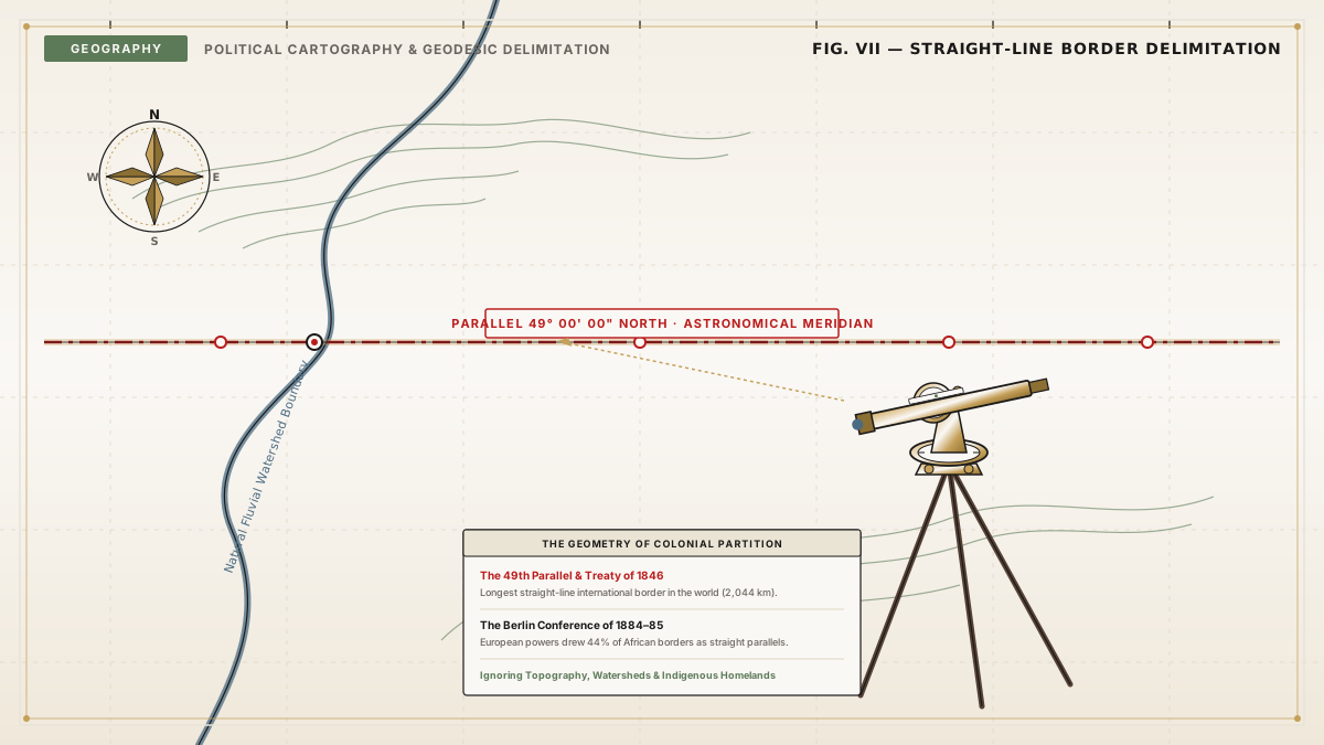
When cartophiles unfold a political atlas of the world, a dramatic visual divergence immediately divides continents. In Western and Central Europe, national frontiers are intricately fractured, jagged, and chaotic—tracing the winding beds of the Rhine and Danube rivers, following the jagged ridgelines of the Pyrenees and Alps, and echoing centuries of feudal skirmishes between neighboring warlords.
Cast your eyes toward North Africa, the Arabian Peninsula, North America, or Central Australia, however, and the geography shifts abruptly into stark geometric abstraction. Entire nations are delineated by crisp 90-degree right angles, parallel lines of latitude, and relentless straight segments hundreds of miles long that slice through sand dunes and salt flats without regard for terrain.
Nature does not draw straight lines. Whenever a straight line appears on a geopolitical map, it is an unmistakable signature of human imperial arrogance: a historical paper artifact created when foreign diplomats in London, Paris, or Berlin drew rulers across distant territories they had never physically visited.
"A straight line on a map is a treaty negotiated in a drawing room by men who never had to walk across the sand they were dividing." — Lord Curzon, British Foreign Secretary, Romanes Lecture on Frontiers (1907)
The 1884 Berlin Conference: Carving Africa with Imperial Rulers
The most consequential exercise in straight-line cartography in human history transpired during the winter of 1884–1885 in the Chancellery of Otto von Bismarck in Berlin.
Fourteen Western imperial powers—including Great Britain, France, Germany, Portugal, and Belgium—convened to negotiate the "Scramble for Africa." At the time, more than eighty percent of the African continent remained under indigenous governance, with deeply established linguistic boundaries, nomadic pastoral routes, and sovereign tribal confederacies. Crucially, not a single African leader or representative was invited to attend the proceedings.
Facing complex inland topographies that European cartographers had not yet surveyed, imperial delegates pinned massive paper maps of the African interior to conference tables and used straightedge brass rulers to partition sovereign spheres of influence:
- The Principle of Effective Occupation: Powers could claim title to coastal lands only by physically occupying them, but they claimed the right to draw straight astronomical lines (hinterland doctrine) inland to claim vast interiors.
- Meridians and Parallels: Enormous boundaries were tied arbitrarily to geographic coordinate grids. For example, the border between modern Namibia and Botswana was fixed rigidly along the 20th and 21st meridians east of Greenwich.
When British Prime Minister Lord Salisbury addressed a banquet in London in 1890 regarding the Anglo-French partition of West Africa, his frankness was chilling:
"We have been engaged in drawing lines upon maps where no white man's feet have ever trod; we have been giving away mountains and rivers and lakes to each other, only hindered by the small impediment that we never knew exactly where those mountains and rivers and lakes were."
The human cost of these geometric abstractions was immense. Modern anthropological audits estimate that straight-line colonial borders dissected more than 177 distinct cultural and ethnic groups across Africa, splitting communities into competing sovereign states while forcing historically hostile rival groups into artificial colonial unions.
The Sykes-Picot Agreement: The Ruler Slices the Levant (1916)
Few geometric lines have cast as dark a geopolitical shadow over contemporary world affairs as the line drawn during World War I by Sir Mark Sykes of Great Britain and François Georges-Picot of France.
In May 1916, while the Ottoman Empire was collapsing, Sykes and Picot met secretly in London to divide the Middle East into British and French mandates. Sykes famously pointed to a British War Office map of the Levant and proposed to Picot:
"I should like to draw a line from the 'e' in Acre to the last 'k' in Kirkuk."
That pencil stroke formed the infamous Sykes-Picot Line. Running diagonally from the Mediterranean coast near northern Palestine to the Persian frontier in northern Iraq, this arbitrary straight division carved ancient Mesopotamia and Syria into artificial imperial zones:
- The British zone (securing access to Persian Gulf petroleum and overland trade routes to British India) created modern Iraq and Jordan.
- The French zone (securing Levantine commercial ports) created modern Syria and Lebanon.
The line deliberately severed historic trade routes, separated Kurdish populations into four separate nations, divided Sunnis and Shiites across arbitrary administrative lines, and ignored millennial tribal balances, creating institutional instability that has ignited regional conflicts for over a century.
+--------------------------------+--------------------+---------------------------------------+
| Border Boundary                | Year Negotiated    | Geographic Reference / Method         |
+--------------------------------+--------------------+---------------------------------------+
| Egypt - Sudan Border           | 1899               | 22nd Parallel North                   |
| Namibia - Botswana Border      | 1890               | 20th & 21st Meridians East            |
| US - Canada Border             | 1818 / 1846        | 49th Parallel North                   |
| Sykes-Picot Partition          | 1916               | Acre to Kirkuk Straight Line          |
| Papua New Guinea - Indonesia   | 1895               | 141st Meridian East                   |
| Algeria - Mali / Niger         | 1900-1919          | Astronomical Azimuths across Sahara   |
+--------------------------------+--------------------+---------------------------------------+
The 49th Parallel: The World's Longest Straight Border
Straight-line borders were not restricted to European conquests in Africa and Asia; they also shaped North America. The boundary separating the United States and Canada along the 49th Parallel North represents the longest straight, undefended border in the world, spanning over 2,000 kilometers from Lake of the Woods in Minnesota to the Strait of Georgia in British Columbia.
Established via the Anglo-American Convention of 1818 and extended to the Pacific Ocean by the Oregon Treaty of 1846, the 49th parallel was chosen primarily because neither nation possessed detailed topographical maps of the rugged Rocky Mountain interior. An astronomical line of latitude provided an indisputable mathematical compromise that could be surveyed independently of local topography.
When the joint British-American boundary commission surveyed the line between 1872 and 1876, the curvature of the Earth and the limitations of 19th-century chronometers produced real-world deviations. The surveyed border is not a mathematically pure line of latitude, but rather a sequence of approximately 900 straight geodesic segments connecting stone boundary obelisks, each deviating by several dozen feet from the true astronomical 49th parallel.
The Modern Legacy: Cartographic Inertia
Why do straight borders persist in the post-colonial era?
When African and Asian nations achieved independence in the mid-twentieth century, their leaders faced an existential cartographic dilemma: should they dissolve colonial borders and redraw frontiers along ethnic and cultural lines, or maintain the inherited lines?
In 1964, the Organization of African Unity (OAU) adopted the Roman legal doctrine of uti possidetis juris ("as you possess under law"). African heads of state recognized that attempting to unravel thousands of miles of arbitrary borders would trigger widespread territorial wars and state collapse across the continent. With few exceptions, they pledged to respect the frontiers inherited upon independence.
The straight lines drawn by Victorian cartographers thus remain etched across modern atlas pages—silent, enduring monuments to the historical moment when geometric drawing instruments in European chancelleries superseded the organic geography of human civilization.
Key Takeaways
- Colonial Hallmarks: Straight geopolitical borders almost universally indicate imperial treaties where foreign powers divided distant territories using astronomical lines rather than natural topography.
- The 1884 Berlin Partition: The Berlin Conference carved up eighty percent of the African continent using meridians and parallels, dissecting over 177 distinct ethnic and linguistic communities.
- The Sykes-Picot Line: Britain and France partitioned the Levant during WWI along an arbitrary line from Acre to Kirkuk, establishing the volatile boundaries of the modern Middle East.
- Uti Possidetis Juris: Newly independent post-colonial states chose to preserve straight colonial borders to prevent catastrophic regional wars over ethnic territory.
Cartographic Treaties & Historical References
- Curzon, George N. Frontiers (The Romanes Lecture). Oxford: Clarendon Press, 1907.
- Fromkin, David. A Peace to End All Peace: The Fall of the Ottoman Empire and the Creation of the Modern Middle East. Henry Holt & Co., 1989.
- Pakenham, Thomas. The Scramble for Africa: White Man's Conquest of the Dark Continent from 1876 to 1912. Random House, 1991.
- Prescott, J. R. V. The Geography of Frontiers and Boundaries. Routledge, 1965.