How Self-Driving Cars See: Sensors Explained
Self-driving cars merge cameras, LiDAR, and radar into one view of the road. Here is how each sensor works, why none can drive alone, and what limits them.
Key takeaways
- Self-driving cars layer cameras, LiDAR, and radar because each sensor fails differently; fusion keeps the system robust when one degrades.
- LiDAR fires millions of laser pulses per second to build a 3D point cloud, while radar cuts through rain and fog using radio waves.
- GPS alone places a car within meters; self-driving requires centimeter accuracy from high-definition maps matched against live sensor data.
- Waymo's published data showed an 80% reduction in injury crash rates over 7.14 million fully driverless miles versus human drivers.
- Bad weather remains the biggest unsolved challenge, which is why commercial driverless services cluster in mild-climate cities.
A self-driving car does not see the road the way you do. Instead of two eyes, it carries a small orchestra of sensors — cameras, laser scanners, radar, and ultrasonic units — whose outputs are fused by software into a single, continuously refreshed picture of the world around it. The entire loop, from a pedestrian stepping off a curb to the car beginning to brake, has to complete in roughly a tenth of a second. The reason for the multiplicity is simple: no single sensor can be trusted alone. Each one fails in its own way, and the art of autonomy is making their weaknesses overlap as little as possible.
What Are the Sensors on a Self-Driving Car?
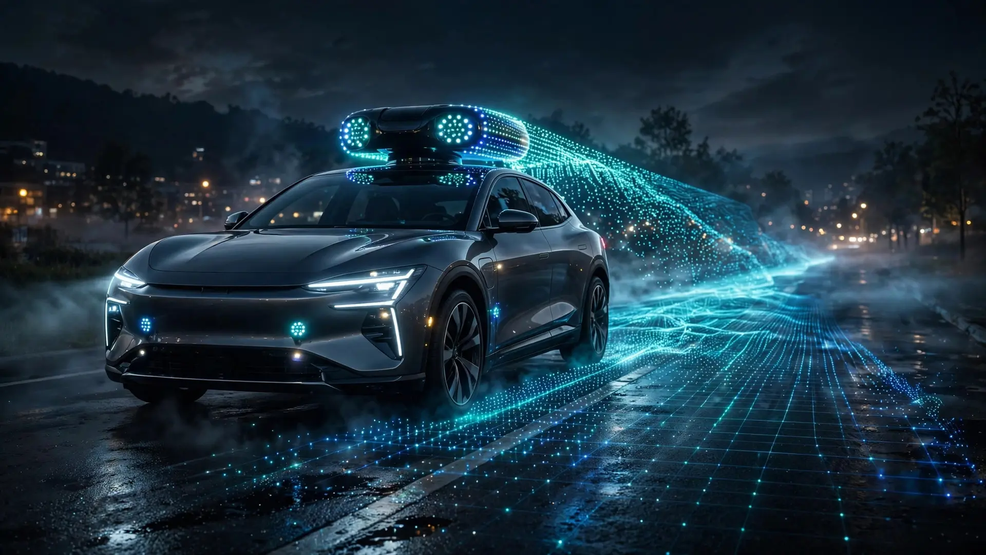
The main trio is cameras, LiDAR, and radar, supported by ultrasonic sensors for close-range work like parking. Cameras are the passive members of the team. They capture light from the environment, just like a human eye, and they are the only sensors that read color and fine detail: lane paint, traffic signals, road signs, the difference between a stop sign and an advertisement on the side of a bus. One leading developer's vehicles carry nearly thirty cameras for a simultaneous 360-degree view, built with high dynamic range so they keep working in low light and can pick out traffic lights and construction zones from hundreds of meters away. For a closer look at the technology behind the lens, see how digital cameras capture an image. LiDAR — short for Light Detection and Ranging — is an active sensor. Spinning as it works, it shoots out millions of laser pulses each second and times every return trip, converting those echoes into a dense 3D "point cloud" that maps the shape of everything nearby: curbs, vehicles, pedestrians, buildings. Because it carries its own light source, LiDAR works identically in daylight and total darkness, and it can resolve details down to a few centimeters at well over a hundred meters. Its weaknesses are cost — early units were bulky and cost tens of thousands of dollars — and weather: heavy rain and fog scatter the laser beams, degrading the picture. Radar rounds out the suite by sending out millimeter-wave radio signals and listening for the echo. The returning signal reveals exactly how far away an object is and, through the Doppler shift, how fast it is moving relative to the car. Radar's decisive advantage is weather: radio waves slice through rain, fog, snow, and dust that blind cameras and LiDAR. The price is resolution — a radar return can tell you something is there and how fast it is moving, but it cannot show you whether it is a plastic bag tumbling across the highway or a small child.
How Does Sensor Fusion Work?
Having three senses is one thing; believing all of them at once is another. The car runs a process called sensor fusion, in which the separate streams are merged into one shared model of reality. The camera may report a person-shaped object, the radar supplies its distance and approach speed, and the LiDAR fills in a precise 3D shape — combined, the software can conclude with high confidence that a pedestrian is a certain distance away and moving toward the road. Crucially, the system does not switch between sensors the way you might switch from sunglasses to wipers. According to Waymo's chief executive, each sensor has its own noisy character, and the noise shows up differently in different environments: on a bright day cameras carry most of the load, while in headlight glare or darkness the camera signal degrades and LiDAR — completely unaffected by light — takes over. Separate encoders process the camera and LiDAR feeds continuously, and the system uses them jointly to form the best view of the world. This is the sharpest point of contrast in the industry: Tesla has argued that cameras alone suffice, since humans drive with vision, while Waymo's position is the inverse — that each sensor's different failure mode makes the fused whole far more robust than any part. Research from Carnegie Mellon's Robotics Institute backs the fusion case: combining camera and LiDAR signals removes false detections and over-segmentation from either sensor alone, and the merged system survives situations where one sensor fails.
How Does the Car Know Where It Is?
Seeing obstacles is only half the problem; the car also needs to know its own position with far more precision than satellite navigation can offer. GPS can place you within a few meters, but driving in a lane demands centimeter-level accuracy. For a deeper look at how satellites keep such precise time, see how GPS satellites keep atomic time. The industry's answer is the high-definition map: a pre-built catalog of lane markings, curbs, medians, and traffic signs, recorded to centimeter precision. The vehicle keeps lining up its live LiDAR and camera views with this stored map, holding its position estimate to roughly ten centimeters. A related technique called SLAM — simultaneous localization and mapping — blends GPS, motion sensors, and wheel-speed readings to estimate position in real time and correct for accumulated errors. The catch is that HD maps go stale: construction, new signage, and changed lane markings all require frequent updates, which is one reason driverless services operate in carefully mapped zones rather than everywhere at once.
What Does the Software Do After Sensing?
Sensing only feeds the perception layer. Once the car knows what surrounds it and where it sits, the software runs a four-step pipeline: detect what lies in its path, classify each object — a pedestrian, a cyclist, a truck — forecast where each one will be a few seconds from now, and plan an appropriate response. Deep-learning models, including convolutional networks and transformers, handle the classification, trained on vast libraries of driving data; prediction models forecast the likely trajectories of every nearby road user. The chosen path is then translated into steering, throttle, and brake commands, and the whole cycle repeats many times per second on onboard computers built to chew through thousands of trillions of operations per second.
Where Did This Technology Come From?
Self-driving vehicles were not born in a tech campus. The lineage goes back to 1977, when engineers at Japan's Tsukuba Mechanical Engineering Laboratory built the first semi-autonomous vehicle. Carnegie Mellon's Navlab project kicked off semi-autonomous driving research in 1984, backed by the US Defense Advanced Research Projects Agency. A turning point came with DARPA's second Grand Challenge in 2005, where driverless vehicles raced across desert terrain and accelerated work on speed, control, and sensor systems. In 2020, Waymo began offering driverless taxi rides in limited geographic areas, an industry first. SAE International's six-level classification now frames the conversation: driverless services like Waymo's operate at Level 4 — full automation within defined areas — while Level 5, a car that can drive itself anywhere under any conditions, remains theoretical. No production vehicle has reached it.
What Are the Remaining Limits?
The most honest answer is weather. US Department of Transportation field tests found that rain and ice could block both radar and camera sensors entirely: some test vehicles interpreted heavy rain as a physical object and braked harshly, while others failed to detect nearby vehicles in rain at all. Even a light snow cover was enough to make one vehicle lose track of lane markings. This is why the commercial deployments you hear about operate in mild climates like Phoenix and parts of California, and why solving all-weather driving will demand both better sensor hardware and enough redundancy that one failing sensor never drops the system below that 100-millisecond response window. A second frontier is seeing around corners — literally. Even perfect sensors only see what is in their line of sight; a pedestrian hidden behind a parked truck or a speeding car approaching an intersection with blocked sightlines remains invisible until almost too late. Vehicle-to-everything communication, which lets cars, traffic lights, and road infrastructure share data wirelessly, could extend perception beyond direct line of sight. It also carries information sensors cannot capture at all, like the real-time state of an intersection ahead. The technology relies on fast wireless networks — the same kind of fifth-generation mobile networks reshaping connectivity — but remains in limited deployment. Safety figures, meanwhile, favor the machines where they are allowed to operate. Waymo's published data through October 2023 covered 7.14 million fully driverless miles across Phoenix, San Francisco, and Los Angeles: injury crashes ran at 0.6 per million miles against 2.8 for human drivers, an 80 percent reduction, and all police-reported crashes at 2.1 against 4.68 per million miles, a 55 percent reduction. The car of the future does not see with one sense but with a fused chorus — and its biggest blind spots are not where the sensors point, but where the weather and the map run out.
Frequently asked questions
How do self-driving cars see the road?
They combine cameras that read color and detail, LiDAR that measures depth with laser pulses, and radar that tracks distance and speed in bad weather. Software fuses all three into one unified model of the surroundings, refreshed many times per second.
Do self-driving cars rely on just one type of sensor?
No mainstream developer relies on a single sensor. Each type has a different failure mode — glare blinds cameras, fog scatters LiDAR, radar sees little detail — so the systems layer them together. One camera-only approach exists, but most companies treat redundancy as the whole point.
Can self-driving cars drive in rain and fog?
Poorly, in most cases. Field tests found rain and ice could block radar and camera sensors, and some test vehicles misread heavy rain as a physical object. That is a major reason driverless services still operate mainly in mild climates.
Are self-driving cars safer than human drivers?
Waymo's published figures from 7.14 million fully driverless miles showed 0.6 injury crashes per million miles versus 2.8 for humans — an 80% reduction. No production vehicle has reached full Level 5 autonomy, so the comparison covers limited operating areas.