Why Does Fog Form on Some Mornings and Not Others?
Morning fog appears when a clear, calm night cools moist air to its dew point, turning vapor into droplets. Clouds, wind, or dry air can spoil the recipe.
Key takeaways
- Morning fog is a cloud at ground level, formed when overnight cooling brings air to its dew point.
- Clear skies, calm winds, and moist air near the ground are the classic recipe for radiation fog.
- Clouds, wind, or dry air can each prevent fog, which is why some mornings stay perfectly clear.
Fog is simply a cloud that has settled at ground level. On the mornings when it appears, the recipe is almost always the same: a clear, calm night lets the ground cool until the moist air above it can no longer hold its water vapor, and that vapor condenses into tiny droplets. When any part of that recipe is missing, the morning stays clear, which is why fog can be thick one day and absent the next.
What has to happen for fog to form?
Air holds water vapor invisibly, but only up to a limit that shrinks as the air cools. The dew point is the temperature at which air becomes saturated, and once air cools to that point, excess vapor must condense. If that condensation happens near the ground, the result is fog: countless tiny droplets floating in the air, dense enough to cut visibility to less than 1 kilometre. When visibility stays between 1 and 2 kilometres, forecasters call it mist instead. Morning fog is usually radiation fog, named for the way it begins. After sunset on a clear night, the ground radiates its daytime heat away to space and cools steadily. The National Weather Service explains that as the surface keeps cooling, and provided a deep enough layer of moist air sits near the ground, humidity climbs to 100 percent and fog forms. It starts at the surface and thickens as the night goes on, because the air above the first fog layer keeps cooling too. Radiation fog can range from just a few feet deep to about 1,000 feet, and it tends to sit still rather than drift, which is why one neighborhood can be fogbound while another a mile away is clear. The role of a light breeze is subtle but important. With no air movement at all, condensation stays on grass and leaves as dew. With a very gentle stir, the droplets get mixed upward into a shallow fog layer. The Royal Meteorological Society's MetLink resource puts that helpful breeze at roughly 1 to 5 kilometres per hour. Stronger wind ruins the effect by mixing drier air in and stopping the surface layer from cooling to saturation.
Why are some mornings foggy and others not?
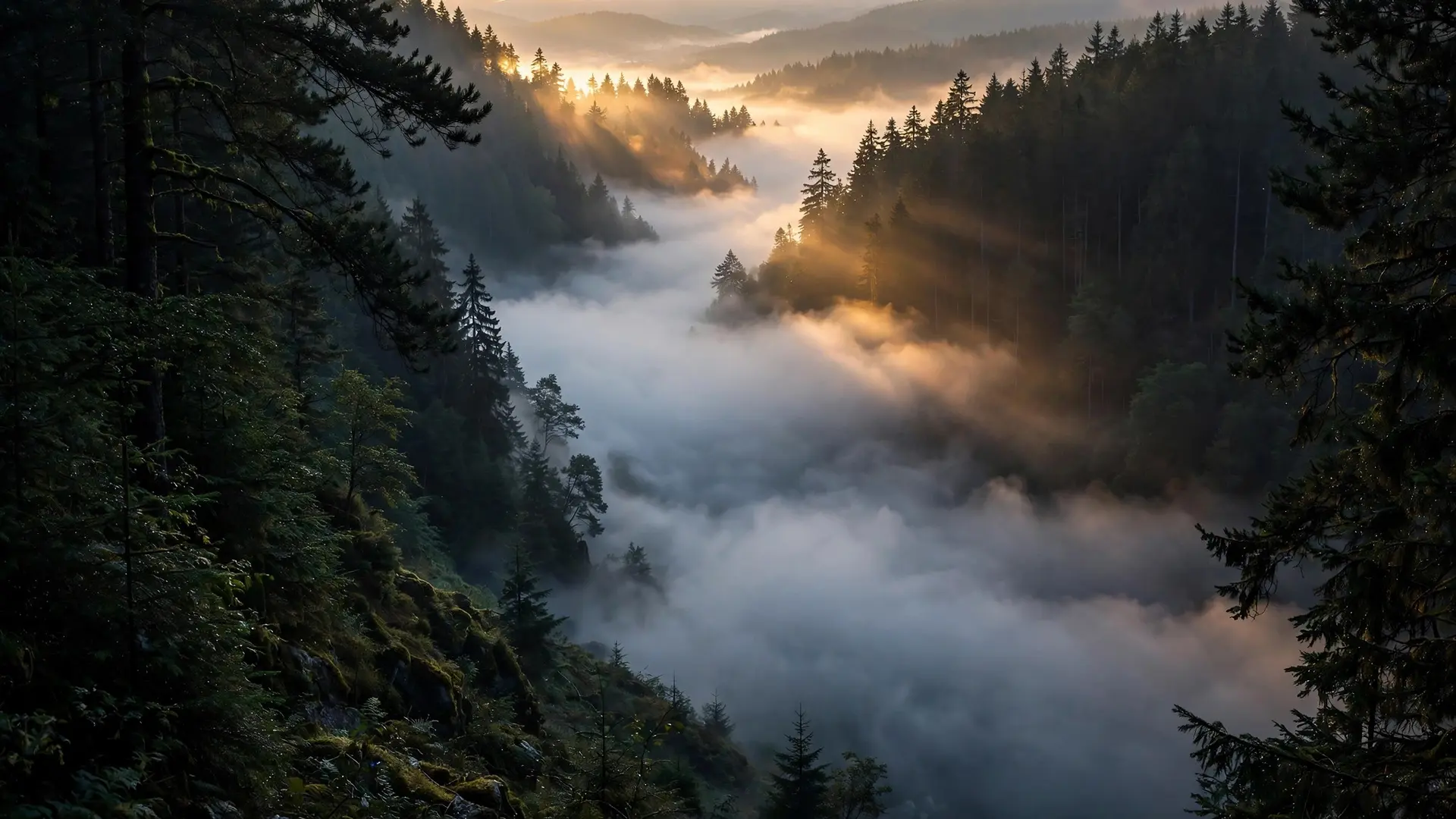
Three ingredients must line up, and each one can fail on its own. First, the sky must be clear. Clouds act like a blanket, trapping heat near the ground and preventing the strong overnight cooling that fog needs. A cloudy night usually means a fog-free morning, even if the air is damp. Second, the wind must stay light. A breezy night mixes the cooling surface air with warmer, drier air above, so the temperature never reaches the dew point. This is why fog favors sheltered spots: valleys, hollows, and places near water, where the air sits undisturbed. The National Weather Service notes that sheltered valleys with little to no wind are among the most favored places for radiation fog to develop. Third, the air near the ground must be moist enough. A night after rain, when the soil is wet and the dew point is high, fog comes easily. After a spell of dry air, the ground can cool all night without ever reaching saturation, and the morning stays crisp and clear. Season matters too: radiation fog is most common in autumn and winter, when nights are long, giving the ground more hours to cool, and the sun is too weak to clear it quickly. In mid-winter, under a low sun, fog can even linger all day. Valleys deserve a special mention. After sunset, air cooling on ridges and slopes grows dense and heavy, then drains downhill and pools on the valley floor. As that pooled air keeps cooling, it saturates and fog forms there first and thickest. The Louisville weather office describes valley fog as a type of radiation fog that can be very dense, yet it tends to vanish quickly once the sun rises and starts evaporating the layer. California's Central Valley has its own famous version, called tule fog, which the National Weather Service says can grow exceptionally thick on many nights from late October through February, fed by a cool, moist layer of Pacific air near the surface under clear skies and light winds.
Are all morning fogs the same kind?
No, and the differences explain some odd-looking mornings. Radiation fog is the classic still-morning type, but advection fog arrives on the move: warm, moist air slides over a colder surface, such as snow or cold water, and cools from below until it condenses. Unlike radiation fog, advection fog drifts horizontally along the ground, which gives away its origin. Other types come from adding moisture rather than cooling air. Steam fog appears when cold air moves over warmer water; the water feeds vapor into the cold air, which condenses into wisps that look like smoke rising from the surface. Frontal fog forms when warm raindrops evaporate into a cooler, drier layer near the ground until that layer saturates. Even a heavy hailstorm can leave a calling card: hail fog forms shortly after, when ice on the ground chills the air just above it to the dew point, though it stays patchy and shallow. Fog's close cousin in the sky is the subject of why clouds stay afloat instead of falling, and its optical effects at sunrise overlap with halos and sun dogs around the sun.
Why does fog usually lift after sunrise?
Sunlight reverses the whole process. The sun warms the ground beneath the fog, and that warmth spreads upward through the layer until the air temperature rises back above the dew point. The droplets then evaporate, often surprisingly fast, in a process sometimes called burning off. MetLink notes that most of the sun's rays are actually reflected from the top of the fog, but enough reach the surface to start the warming, and once it starts, the clearing spreads. Thick fog takes longer, and so does fog under a weak winter sun or in a deep valley that the sun reaches late. Strong wind can also clear fog by stirring and dispersing the droplets, though wind is a double-edged tool: the same mixing that breaks up morning fog is what prevents it from forming in the first place. And on the rare mornings when fog freezes instead of lifting, it becomes freezing fog, whose droplets stay liquid until they touch a surface and coat it with ice. So the next time you wake to a white morning, you are seeing the previous night's weather written in the air: a clear sky, still air, and damp ground, all quietly doing their work while you slept. On the mornings when any one of them was missing, the sky simply had nothing to condense.
Frequently asked questions
What is the difference between fog and mist?
Fog cuts visibility to less than 1 kilometre, while mist leaves visibility between 1 and 2 kilometres. Both are droplets suspended in the air; fog is simply denser.
Why does fog usually clear after sunrise?
Sunlight warms the ground, which warms the air above it back past the dew point, so the droplets evaporate. Thicker fog in valleys or in weak winter sun can take longer.
Why is fog thicker in valleys?
Cool, dense air drains downhill overnight and pools in valley floors, where it keeps cooling until it saturates. Sheltered valleys with little wind are ideal fog traps.
Sources
- How Fog Forms, National Weather Service Louisville
- Radiation Fog, National Weather Service
- Fog, MetLink, Royal Meteorological Society