The Congo River: What Is the Deepest River on Earth?
The Congo River plunges to 220 m (720 ft) in its lower gorges, deeper than any other river. Here is how scientists measured it, and what lives down there.
Key takeaways
- The Congo River is the deepest river on Earth: in 2008, sonar surveys measured 220 m (720 ft) in its lower reaches.
- The previous depth record-holder was China's Yangtze River, which the Congo beat by a wide margin.
- The lower Congo descends 270 m from Malebo Pool through the Crystal Mountains gorges over 498 km to the Atlantic Ocean.
- The river's deep pools shelter blind, colorless fish such as Lamprologus lethops, found nowhere else on the planet.
The deepest river on Earth is the Congo River in Central Africa. In 2008, a joint expedition by the U.S. Geological Survey and the American Museum of Natural History dropped echo sounders into its lower reaches and measured 220 m (720 ft), deeper than the previous record-holder, China's Yangtze. Key facts
- The echo sounder registered 220 m in one stretch of the Lower Congo: "This is the deepest river in the world, there's no question about it," said AMNH ichthyologist Dr. Melanie Stiassny. (American Museum of Natural History)
- The previous depth record-holder was China's Yangtze River. (American Museum of Natural History)
- The lower Congo descends 270 m from Malebo Pool through the Crystal Mountains gorges, 498 km downstream to the Atlantic Ocean. (U.S. Geological Survey)
- At Bulu Reach the survey found a jagged underwater canyon 160 m deep, with depth-averaged currents topping 4 m/s. (American Museum of Natural History, U.S. Geological Survey)
- The Lower Congo holds 320 fish species, 90 found nowhere else, including the blind, colorless cichlid Lamprologus lethops, found only near Bulu. (American Museum of Natural History)
- The Congo is Africa's second-longest river at almost 3,000 miles, flowing through the Congo rainforest, the second-largest rainforest on Earth. (Pilot Guides)
How deep is the Congo River, exactly?
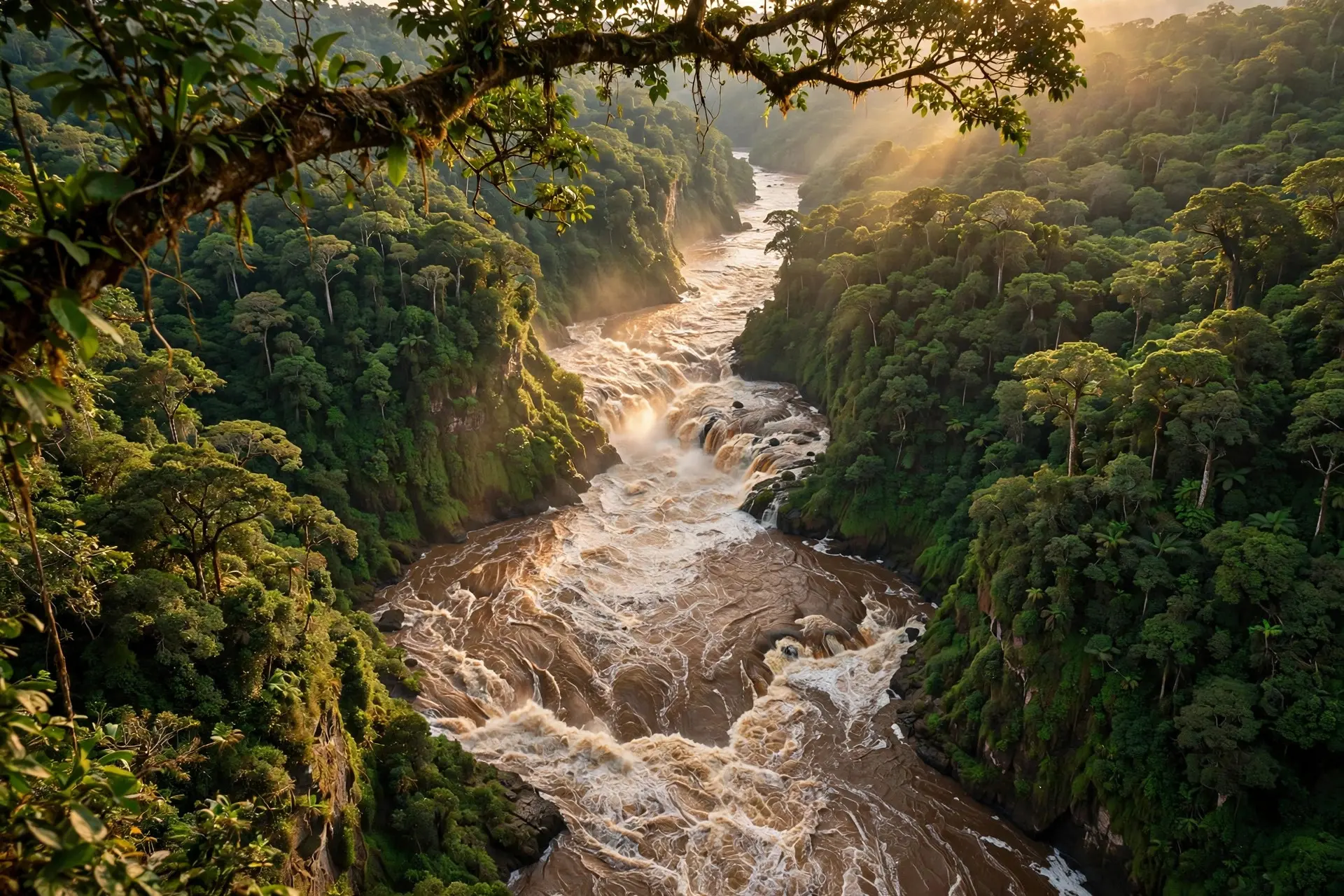
The number is 220 m (720 ft), measured in the Lower Congo, the roughly 350 km stretch between the twin capitals of Kinshasa and Brazzaville and the Atlantic coast. That is deep enough to submerge a 60-story building with room to spare, in a river whose surface can look like any other wide brown waterway. The depth is not spread evenly. It concentrates in the gorges of the Livingstone Falls, where the river drops 270 m through the Crystal Mountains over 498 km. At Bulu Reach, one bend in this violent stretch, the 2008 survey mapped a jagged canyon 160 m deep, with turbulent flow structures spanning the full depth and currents exceeding 4 m/s. To map currents like these, the scientists had to use instruments designed for the ocean.
How did scientists measure the deepest river? A timeline
Before 2008, nobody had mapped the Lower Congo's riverbed or measured its currents in any more than a cursory way. The river was a blank spot on the bathymetric map.
| When | What happened |
|---|---|
| Before 2008 | The Lower Congo's depths were guesswork; no detailed riverbed map or current survey existed. |
| Summer 2008 | USGS hydrologist John Shelton and AMNH geographer Ned Gardiner teamed up with a National Geographic expedition crew, rigging kayaks with GPS loggers and echo sounders. |
| Summer 2008 | A team of world-class kayakers battled whitewater for 130 km over 5 days, taking depth readings all the way; one whirlpool submerged a kayak's full 2.7 m length. |
| 2008 season | The echo sounder registered 220 m in one stretch, far deeper than the Yangtze's record; the Bulu canyon mapped at 160 m deep. |
| December 2009 | The American Museum of Natural History published its account of the expedition and the evolutionary puzzle of the river's fish. |
Why does the Lower Congo run so deep?
It is a matter of plumbing. For most of its length the Congo is slow and lazy, drifting through Central Africa's tropical forests. Near Kinshasa it puddles against a natural rock barrier, forming an expansion called Pool Malebo. Then the water spills at 50,000 cubic metres per second down a steep gorge on the pool's western side, churning through the world's most extreme rapids.
Squeeze that much water into a narrow bedrock hallway and it has nowhere to go but down. The riverbed becomes a drowned mountain range of peaks and troughs, with deep pools carved where the current slams into rock. The same violence that dug the pools also isolates them: whirlpools and shear zones act as walls of water, splitting fish populations apart and driving the furious speciation that makes the Lower Congo one of the most biologically diverse rivers on Earth.
What most people get wrong about the Congo
The first error is naming the Amazon as the deepest river. The Amazon is the giant by discharge and by length debates, and its story is worth its own telling, but on maximum measured depth the Congo stands alone. The 2008 survey settled that question with instruments, not adjectives. The second error is assuming a great river is navigable end to end. The Congo is not. The Livingstone Falls, a series of 32 falls and rapids with an elevation change of 270 m over 350 km, slam the door between the navigable middle river and the sea. Ocean ships cannot sail up to the interior, which is why Kinshasa and Brazzaville grew where they did, and why Henry Morton Stanley's 1876-77 expedition took nearly three years to force the river's full length. The third error is picturing the blind fish as cave dwellers. Lamprologus lethops, the blind and colorless cichlid locals call mondele bureau ("white man's office"), lives not in a cave but in the river's lightless depths. It has never been seen alive; the specimens scientists study are found dead, floating at the surface, apparently launched upward by whirlpools so fast that gases bubble out of their blood, like a diver with the bends.
The takeaway
The Congo is the deepest river on Earth because it is also one of the most violent: a sea-sized flow crammed through a stone hallway, dropping 270 m to the Atlantic and digging pools 220 m deep along the way. The depth was confirmed only in 2008, which means one of the planet's greatest rivers kept its biggest secret into the 21st century. For the longest river on the same continent, see the story of the Nile; for a river that built empires instead of gorges, the Danube is the contrast. How we made this article: FactSpire researched and drafted it with AI assistance and checked every fact against the sources listed above.
Frequently asked questions
Where exactly is the deepest part of the Congo River?
In the Lower Congo, the roughly 350 km stretch between Kinshasa and the Atlantic coast, where the river squeezes through the Livingstone Falls gorges. The 220 m reading came from this reach, and a jagged underwater canyon at Bulu Reach measured 160 m deep.
How do scientists know the Congo is 220 m deep?
In the summer of 2008, hydrologists from the USGS and the American Museum of Natural History surveyed the Lower Congo with echo sounders and acoustic Doppler current profilers, some mounted on kayaks. The echo sounder registered 220 m in one stretch, the deepest river measurement ever recorded.
Why does the Congo run so deep in its lower reaches?
Below Pool Malebo, the river drops 270 m through narrow bedrock gorges in the Crystal Mountains. An enormous volume of water forced through a tight channel has nowhere to go but down, scouring deep pools and underwater canyons into the rock.
What lives in the deepest parts of the Congo?
The Lower Congo holds 320 fish species, 90 of them found nowhere else. The strangest is Lamprologus lethops, a blind, colorless cichlid locals call mondele bureau. It has never been seen alive, only found dead at the surface, likely popped up from the depths by violent whirlpools.
Sources
- Speciation: Why Are Congo's Fishes Evolving So Quickly?, American Museum of Natural History
- Velocity mapping in the Lower Congo River: A first look at the unique bathymetry and hydrodynamics of Bulu Reach, U.S. Geological Survey
- The Congo River, Pilot Guides