How Does the Dujiangyan Irrigation System Still Work?
Dujiangyan still waters the Chengdu Plain after 2,250 years because it never dams the Min River: it splits, spills and throttles the flow instead.
Key takeaways
- Built around 256 BC, Dujiangyan controls the Min River without dams, using natural topography and river bends.
- The Yuzui fish-mouth levee sends about 60% of the flow to irrigation in the dry season and 60% to flood discharge in floods.
- The Feishayan spillway throws excess water and sediment back to the outer channel before it can clog the system.
- The Baopingkou bottleneck, cut through rock, caps how much water can ever enter the Chengdu Plain.
- UNESCO records the system irrigating 668,700 hectares today, and it survived the 2008 Sichuan earthquake basically undamaged.
Dujiangyan still works because it never tries to defeat the Min River. It does not dam it, block it or hold it back. Instead, three structures at the river's edge split the water, spill the excess and throttle the intake, so the river itself does the work of deciding how much goes to the fields and how much goes to waste. That is why a system built around 256 BC still waters the Chengdu Plain today, while countless dams of later centuries have silted up and failed.
What problem was Li Bing trying to solve?
The Min River runs off the high ground of the Tibetan Plateau's eastern edge and reaches the flat Sichuan Basin, where it suddenly slows and spreads. China Travel's account of the project describes the result vividly: the current loses its grip on the silt it carries, the riverbed silts up, and the abundant water overruns its banks like a runaway horse. The Chengdu Plain was fertile but cursed, flooded in summer and short of water in winter, and its farmers starved in both seasons. Li Bing, the Qin official in charge of Shu, the region covering modern Sichuan, surveyed the river with his son and local water-control specialists before building anything. His answer rejected the obvious solution. A great dam would have stopped the floods, but it would also have stopped the river, trapping silt behind a wall until the reservoir filled and the dam itself became a danger. Instead, Li Bing's team cut a channel through Yulei Mountain, the hill that blocked the river's path, and built a set of low structures that would guide the water rather than imprison it. UNESCO records that the system was originally constructed around 256 BC and was modified and enlarged during the Tang, Song, Yuan and Ming dynasties, so what stands today is not a frozen relic but a living design refined over two millennia.
How does the fish-mouth levee split the river?
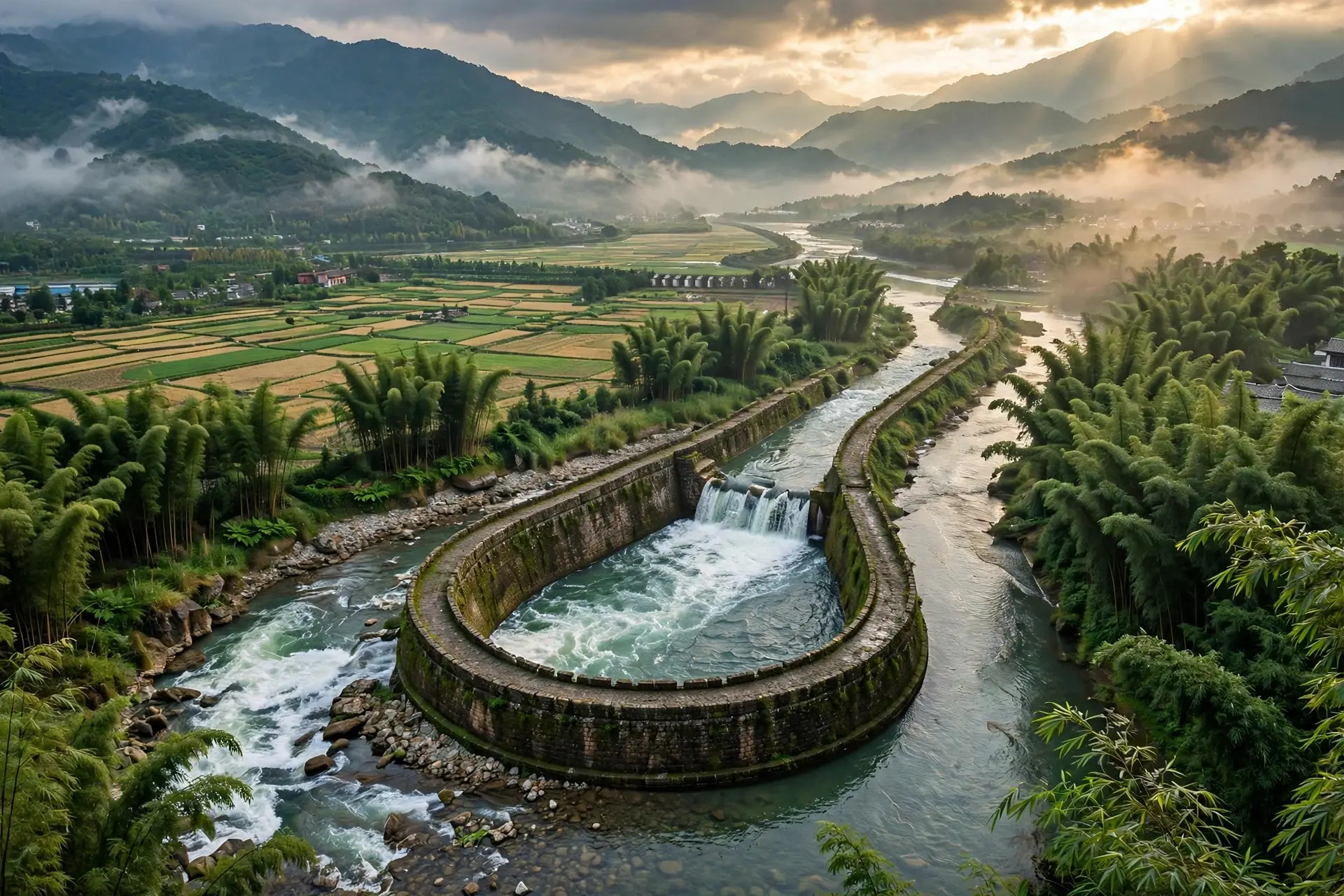
The first structure a visitor meets is the Yuzui, the fish-mouth levee: a wedge-shaped jetty standing in the river where it bends, dividing the Min into two channels. The inner channel, deep and narrow, carries water toward the Chengdu Plain. The outer channel, shallow and wide, carries the river on its natural course and takes the flood.
The split is not fixed; it changes with the season, and that is the genius of it. China Travel explains that the inner riverbed sits lower than the outer channel. In low water, the slower current drops toward the lower bed, and about 60% of the flow enters the inner channel for irrigation, with 40% going down the outer channel. In flood season, the swollen river's main current straightens across the bend, a whirlpool forms before the Yuzui, and centrifugal force throws about 60% of the water down the outer channel, leaving only 40% for the inner channel. The system thus feeds the fields when water is scarce and protects them when water is dangerous, without any gate being raised or lowered. Engineers call this the four-to-six ratio, and it runs entirely on the shape of the riverbed. The same whirlpool solves the silt problem before it starts. In flood season, China Travel reports, about 80% of the sand is carried away by the 60% of water flowing into the outer channel. Only the remaining 20% enters the inner channel, where the next structure deals with it. This matters enormously, because silt is what kills irrigation systems: a channel that cannot shed sediment eventually chokes on it. Dujiangyan was designed to shed sediment from the first bend.
What do the spillway and the bottleneck do?
The second structure is the Feishayan, the flying sand spillway: a low weir on the side of the inner channel, just before the final bottleneck. When the inner channel carries more water than the fields can take, the excess spills over this low wall and back into the outer channel, carrying sediment with it. China Travel notes that water overflowing the Feishayan leaves only about 10% of the sand in the inner channel by the time the flow reaches the bottleneck, so clear water, not mud, goes on to irrigate the plain. The spillway also has a height relationship with a carved scale on the rock beside the bottleneck: water above a certain mark on the scale overflows the weir, which keeps the inner channel at a steady level.
The third structure is the Baopingkou, the precious bottle-neck: a narrow breach, about 20 metres wide, cut through the rock of Yulei Mountain. It is the final throttle on the whole system. No matter how violently the Min floods upstream, only so much water can pass through a gap that narrow, so the volume entering the Chengdu Plain is capped by geometry rather than by human judgement. Beyond it, the water divides again and again into a fan-shaped network of canals spreading eastward across the plain, each branch taking its share by gravity alone. UNESCO describes the three structures together, the Yuzui Bypass Dike, the Feishayan Floodgate and the Baopingkou Diversion Passage, as controlling the water from the upper valley of the Minjiang, and credits the system with comprehensive benefits in flood control, irrigation, water transport and general water consumption. Compare this with other ancient waterworks and the difference sharpens. Roman engineers moved water with magnificent arched aqueducts, but those were delivery pipes: they carried a fixed supply from a spring to a city, and they needed constant maintenance to keep flowing, as the story of Rome's great aqueducts shows. Dujiangyan is not a pipe. It is a negotiation with a living river, rebuilt into the landscape so that the river's own moods do the regulating.
Why hasn't it silted up or fallen apart in 2,250 years?
The short answer is maintenance, raised to the status of ritual. Li Bing left his successors a simple injunction, inscribed on a cliff by later generations and quoted by China Travel: dig deep the channels, keep low the embankments. Every year, in the dry season, workers dredged the silt from the channels and repaired the low embankments, so the geometry that made the system work never drifted out of shape. A dam that is neglected fails catastrophically; a diversion system that is neglected merely loses efficiency, and annual repair kept Dujiangyan's efficiency intact through dynastic collapse, war and earthquake. The record bears that out. UNESCO states that the system, begun over 2,250 years ago, now irrigates 668,700 hectares of farmland, and that it was inscribed on the World Heritage List in 2000 as a major landmark in the development of water management. During the Sichuan earthquake of May 12, 2008, UNESCO reports, the Dujiangyan Irrigation System was basically undamaged, while some nearby Taoist shrines were damaged and later repaired. A structure with no great wall to crack and no reservoir to burst had little to break. There is a final misconception worth clearing up. Dujiangyan is sometimes described as a single ancient invention, built once and left alone. The truth is the opposite, and more impressive. The system survived because every generation rebuilt it: the Tang, Song, Yuan and Ming dynasties all modified and enlarged it. What endures is not any single generation's timber and stone but the idea: split the river, spill the surplus, throttle the intake, and let the water do the work. Like the water tunnels of ancient Persia, which also survived by working with gravity rather than against it, Dujiangyan proves that the most durable engineering is often the gentlest. Two thousand two hundred and fifty years of harvests on the Chengdu Plain are the evidence.
Frequently asked questions
Why didn't Li Bing just build a dam?
A dam would have blocked the river and trapped sediment behind it. Dujiangyan instead divides the Min River and lets it keep flowing, so floodwater, silt and irrigation water are all handled by the river's own movement, a design UNESCO says uses natural topographic and hydrological features without dams.
How does the system change between dry and flood seasons?
The split at the Yuzui reverses with the season. In low water about 60% of the flow enters the inner irrigation channel, while in flood about 60% goes down the outer channel, because the river's main current shifts across the bend as its volume rises.
What stops the irrigation channels silting up?
Two defences. The whirlpool before the Yuzui sends about 80% of the sand down the outer channel in flood season, and the Feishayan spillway throws much of the remaining sediment out of the inner channel before it reaches the Baopingkou.
Is Dujiangyan still working, or is it just a historic site?
It is still working. UNESCO states that the system, begun over 2,250 years ago, now irrigates 668,700 hectares of farmland, and that it was basically undamaged by the Sichuan earthquake of May 12, 2008.
Sources
- Mount Qingcheng and the Dujiangyan Irrigation System, UNESCO World Heritage Centre
- Dujiangyan Weir, China Travel
- Mount Qingcheng and the Dujiangyan irrigation system, China Culture